
Summit Township Neighbors by Parcel
The most reliable starting point for Summit Township neighbors is a parcel map. The Jackson County GIS TaxViewer searches by address, owner, or parcel ID and separates location fields from owner mailing fields. Its popup can show PIN, P_FULLADD, P_CITY, P_ZIP, GOVUNIT, LEGAL_DESC, LIBERPAGE, and an updated date. That makes it a strong way to identify the immediate block. It does not turn parcel ownership into proof of occupancy, nor does it create an official notice list.
| Source | What It Shows About a Block | Access Method |
|---|---|---|
| Jackson County GIS TaxViewer | Nearby PINs, parcel addresses, owner fields, legal descriptions, and government units | Public online map, selection tools, printable output |
| Summit Township BS&A | A second property, tax, assessment, permit, utility, or sales route when the service applies | Public search by address, name, or parcel number |
| Michigan voter and QVF routes | Status or local-clerk information, and lawfully released geographic voter data | MVIC, local clerk, or written QVF request |
| Public civic organizations | Meeting, contact, and community context, not a private household roster | Public contact page, phone, or meeting information |
| Library and historical sources | Earlier street or community context and dated directory evidence | JDL, archives, or in-person reference help |
Use the table as a source boundary. GIS and BS&A may reveal property ownership or a mailing field. MVIC and the public QVF process follow election-law redactions. A library directory is historical, and a civic group page is a public contact lead. None of those sources should be stretched into a conclusion about every person at an address. Start with a current parcel, identify what record is needed, and retain the source date.
GIS Buffers for Summit Township Neighbors
TaxViewer has a selection box for multiple parcels and a buffer tool that accepts a distance from 1 to 1,000 feet. Select the starting parcel, choose a narrow distance that fits the purpose, and inspect the neighboring parcel shapes one at a time. Ctrl or Meta click can add or remove parcels from a selection. The map can create printable maps and reports for the selected group, but that output is a visual selection. It is not a legal notice list and should not be treated as one.
The Jackson County parcel viewer provides the search, layer, and selection controls used for a limited block review.
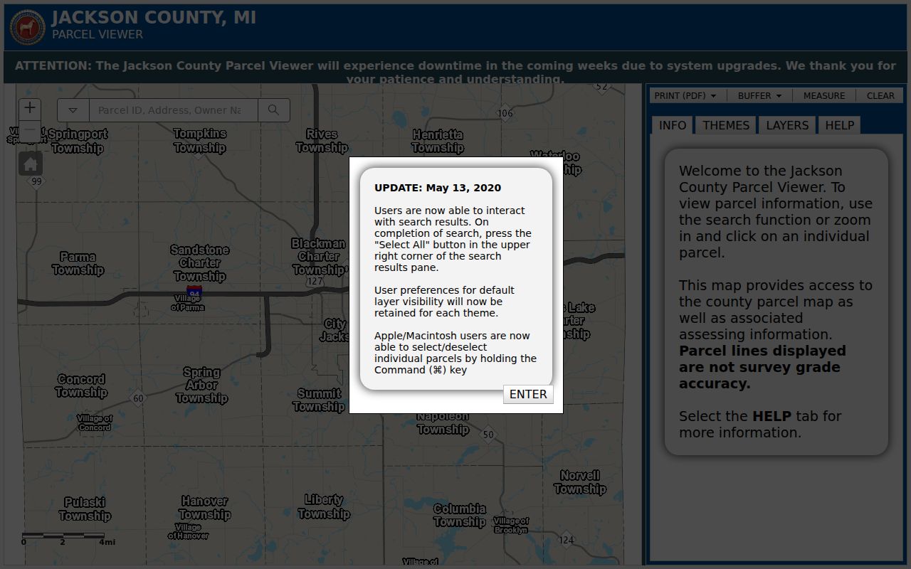
Its parcel card gives a practical place to compare nearby PINs and legal descriptions while keeping mailing fields distinct from property addresses.
Search one address first. If it does not return a result, try the owner name or a normalized PIN. Save the access date and the map’s own updated date. GIS says the viewer is updated weekly and cautions that a parcel layer may not align exactly with other imagery or layers. That warning matters when a road, lake edge, or aerial image appears to tell a different story from the parcel boundary.
Confirm Summit Township Neighbor Boundaries
Before putting adjacent parcels in one Summit Township block, read GOVUNIT. The City of Jackson occupies territory in the township’s northeast area, and Jackson mailing labels can be used for places that are not in the same local government unit. A Jackson address, city label, or ZIP alone therefore does not settle jurisdiction. The GIS government-unit field is the control point for this check. Pair it with the property address, PIN, and legal description when a block crosses a municipal edge.
Road, water, zoning, hydrology, subdivision, contour, and historic-aerial layers are useful orientation aids. They can explain why a block feels connected or show the setting around a parcel. They do not prove ownership, occupancy, a township line, or a person’s address. For a zoning question, the official township zoning map is available for examination at the Clerk’s office, which is the appropriate in-person confirmation route.
Map a Summit Township Neighbor Block
A small-area neighbor search should move from address to parcel, then from parcel to nearby parcels. Keep the steps narrow. The current parcel is the reference point, not a reason to infer who occupies every surrounding property. A parcel can have a changed street number, multiple associated lots, or an owner whose mailing location differs from the situs address. The legal description and PIN are often the steadier bridge when address labels change.
- Enter the complete address in TaxViewer and record its
PIN,P_FULLADD,GOVUNIT, legal description, and updated date. - Use a selection box or a minimal buffer to identify the adjoining parcels, then open each parcel card separately.
- Compare the owner field, owner mailing field, property address, and legal description without treating any mailing field as proof of occupancy.
- Use BS&A for a second property check when applicable. If the question grows into a whole street’s record chain, move to the dedicated street process.
The Summit Township street directory has the fuller address-by-address workflow for a named road. For a block question, avoid turning the parcel map into a broad list. County GIS can be reached at 517-768-6692 or gis@mijackson.org when a map or field needs technical clarification. A request for an existing local government record may also go to the proper township or county custodian, in person, by phone, or in writing.
Summit Township Neighbor Civic Geography
Polling-place information can orient a reader to Summit Township’s civic geography, but it does not identify voters or prove where a neighbor lives. The county’s official list assigns precincts 1 through 3 to Cornerstone Christian Church at 2395 W High Street, precincts 4 through 6 to Summit Township Hall at 2121 Ferguson Road, and precincts 7 and 8 to Jackson Free Methodist Church at 2829 Park Drive. Assignments can change for an election, so use the live county page or MVIC for the date in question. A place on the list is a civic location, not a list of the people who vote nearby.
The Jackson County polling-locations page shows the current official precinct reference for Summit Township.
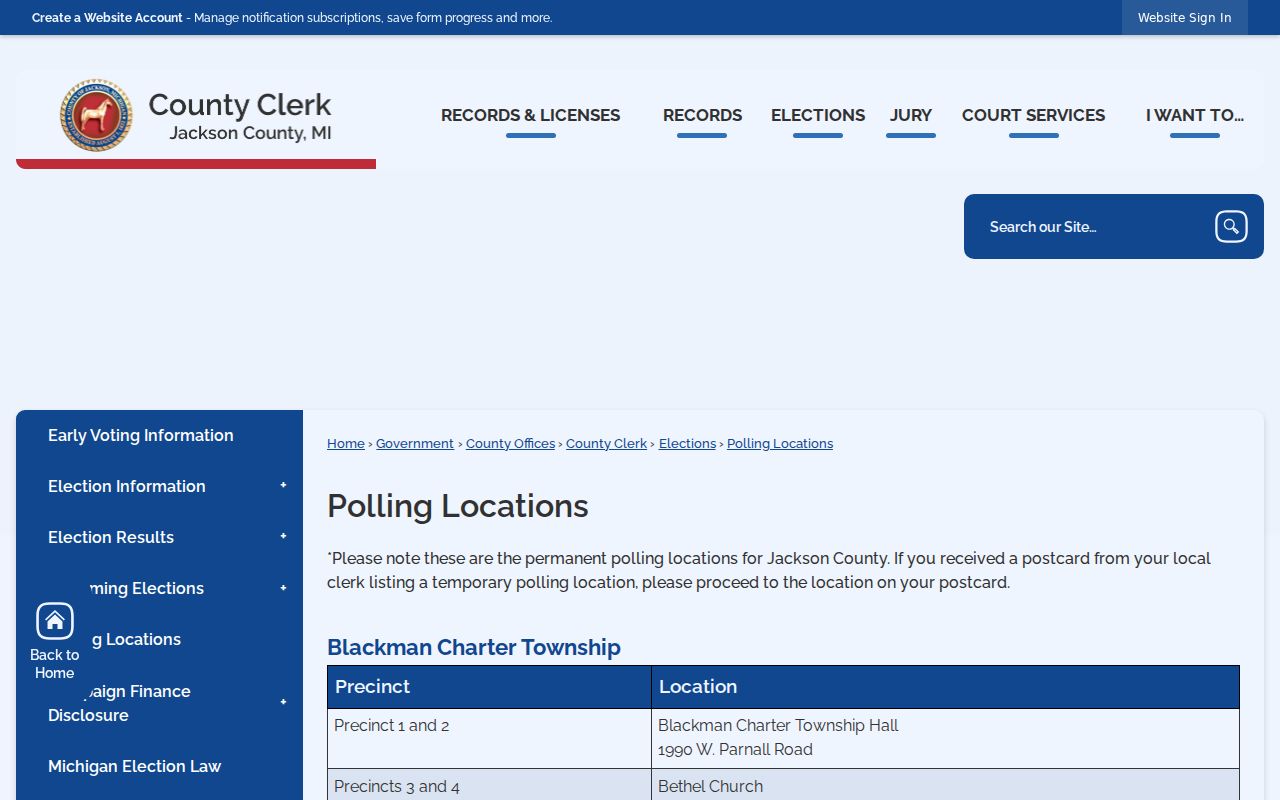
The page helps distinguish precinct orientation from an individual voter record, which has its own access rules and redactions.
Michigan treats voter registration records as public through its statutory process, while protecting fields including identification information, month and day of birth, phone, email, signature, and ACP-related address information. For a lawful data request, use the written QVF request form’s geographic scope and delivery choices, or contact the township clerk or Jackson County Elections at 517-768-6759. Do not use precinct information to guess at a person’s registration status.
Summit Township Neighbor Contacts
Public organizations are a better community layer than private member lists. They offer a meeting place, a contact route, and a reason the organization serves the area. They do not provide a substitute for consent or an open roster of local households. The Vandercook Lake Lions Club, Jackson Lake Association, and Jackson District Library are useful starting points when the purpose is community context, historic research, or a public event inquiry.
| Public Contact | What It Provides | How to Use It |
|---|---|---|
| Vandercook Lake Lions Club | Public contact and meeting details at Vandercook Lake Community Center | Contact the club through its public page, not for a private membership list |
| Jackson Lake Association | Public community, environment, safety, events, and membership route | Use the organization’s public contact or membership channel |
| Jackson District Library | Local-history research, newspapers, directories, maps, and reference help | Use online resources or ask library staff for dated historical material |
The Vandercook Lake Lions Club contact page lists second- and fourth-Wednesday meetings at 6 p.m. at the community center, 4628 Francis Street.
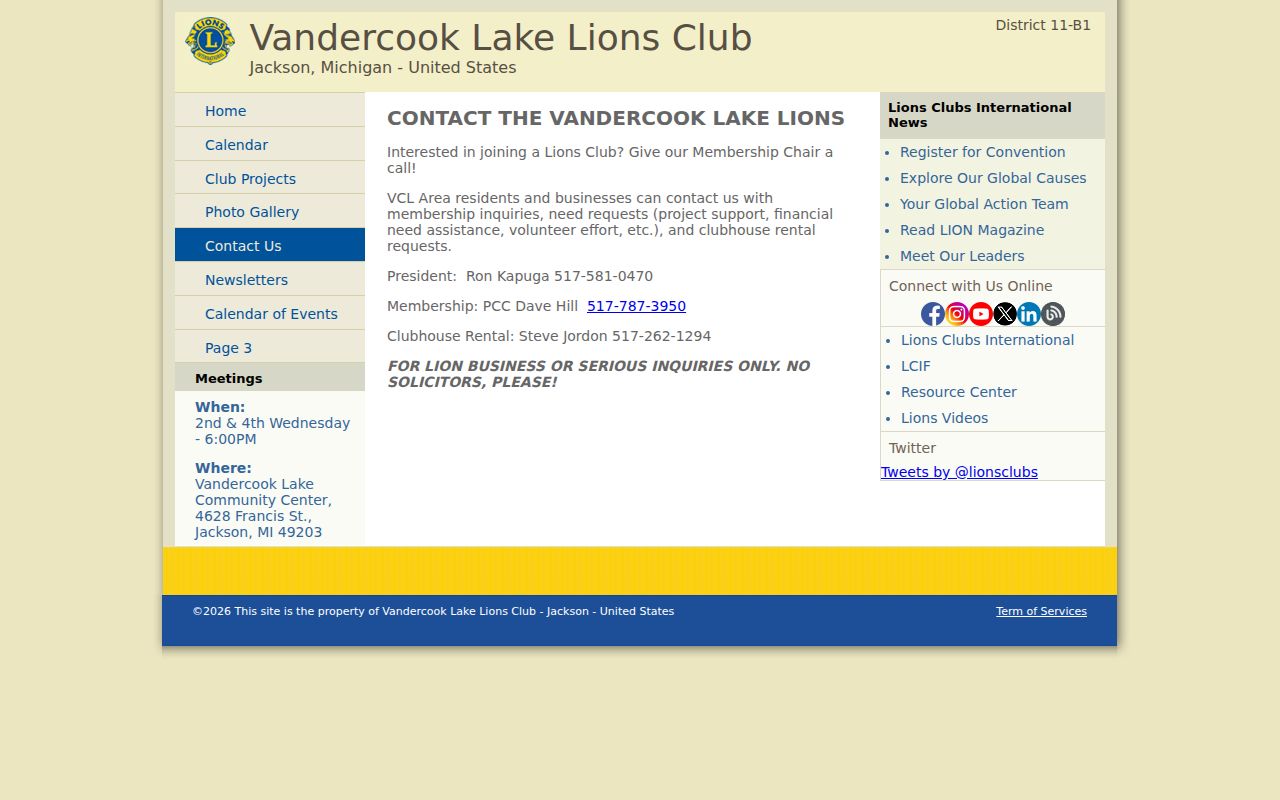
It is a contact lead for local civic context, not evidence about a private roster or the residents who live around the meeting place.
Historic Summit Township Neighbor Context
TaxViewer includes historic aerial themes for 2025, 2020, 2015, 2011, 2007, and 2000. Pair an aerial year with a dated assessment, deed, directory, or map when the question is how a place changed. An aerial can provide time-stamped context for streets, water, and development. It cannot establish title, a legal boundary, present occupancy, or the identity of a neighbor.
Vandercook Lake County Park is another local orientation clue. Its public history reaches back to Hague Park and the Jack Rabbit figure-eight coaster, an older place story rather than a present record about people. For historical addresses and community labels, the Jackson District Library, archives, and older directories are the better fallback than a current parcel map.
Note: Preserve the map year and original community label when using historic material alongside a modern Summit Township parcel.
Official Tools for Summit Township Neighbors
Official and commercial categories have different roles. A government or library source identifies its custodian, access limits, and record type. A compiled commercial category may combine data from different dates and sources, so its entries should never replace the underlying record. For a narrow block question, use the official source that matches the fact and retain its date. That gives a reader a way to check the result at the office that holds it.
| Category | Best Use | Key Limit |
|---|---|---|
| Official parcel and assessment records | PIN, property location, government unit, ownership role, and legal description | Owner and mailing fields do not establish occupancy |
| Election and clerk records | Lawful voter-status or precinct administration questions | Protected fields and addresses remain redacted or confidential |
| Library, archive, and civic sources | Historical or community context and public contact routes | They are dated context, not current-residency proof |
| Compiled commercial category | A starting lead that requires independent checking | Source dates, accuracy, and scope may be unclear |
When an online source cannot answer the question, use the fallback that fits the record: contact county GIS or the township assessor for property data, seek a specific existing record through the public-records process, ask JDL for historical help, or use a civic organization’s public contact channel. A records request should identify the existing record, custodian, date range, and format. It is not a request to assemble a new neighbor list.
Privacy Limits for Summit Township Neighbors
Parcel data is not a complete picture of a block. An owner mailing field can differ from the property address. A recorded document shows a transaction role, not necessarily an occupant. Court and vital records have their own disclosure rules, while voter information carries redactions. Michigan’s Address Confidentiality Program can provide a substitute address and mail forwarding for qualifying participants. Do not use a sequence of public tools to reconstruct a protected address, phone number, email, signature, driver information, or date-of-birth detail.
Lawful use. Use a Summit Township neighbor search for a specific, lawful reason and stop when that need is met. Stalking, harassment, intimidation, and unwanted surveillance are prohibited.
For a privacy concern, ask the relevant custodian about its correction, redaction, or confidentiality process. The Michigan Attorney General’s ACP route begins with an application assistant for people seeking address protection. A map, civic contact page, or historic directory should never be used to prompt repeated unwanted contact with a person or a household.